2009 Holy Land Tour – Turkey
Part 3 – Antalya, Perga, Aspendos, Pisidian Antioch
Click on photos and charts for larger version
For the past two weeks, I have been telling you about our recent Holy Land trip to the nation of Turkey. I shared with you how much of the Bible, especially the New Testament, involves places that are located in modern-day Turkey. In fact, there are 33 places named in the Bible that are located in this country.
I have already taken you to Istanbul and Cappadocia. While in Cappadocia, we visited places lined with the unique fairy chimneys. We took a stroll through the underground city of Kaymakli. And we were amazed at the cave churches at Göreme.
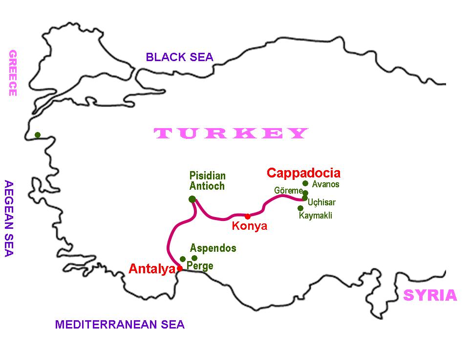
Today, we take leave of Cappadocia, jump on our bus that we call, “our white cocoon,” and head west. We will spend a long day on our bus – probably a total of 7 or 8 hours. We travel past the city of Konya without stopping. In the Bible, this city is called Iconium.
We arrive at the ancient city of Antioch of Pisidia. At this point, I am going to deviate from our itinerary, and will cover Pisidian Antioch later. I think you will see why.
After spending some time at Antioch, we head south through the Taurus Mountains. We finally descend into the coastal city of Antalya. This city is part of the Turkish Riviera.
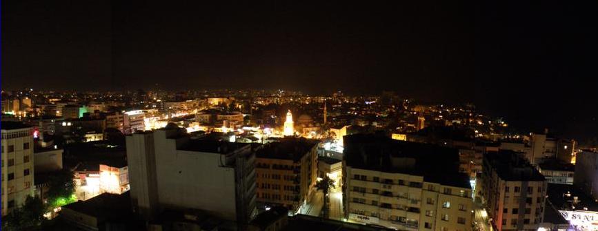
We go to our hotel, and that evening I took three photos from our hotel room, from which I have made a panorama of the city. We were in this hotel for two nights.
Perga
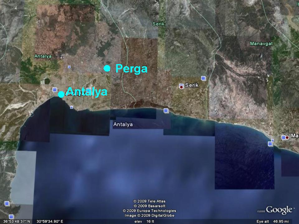
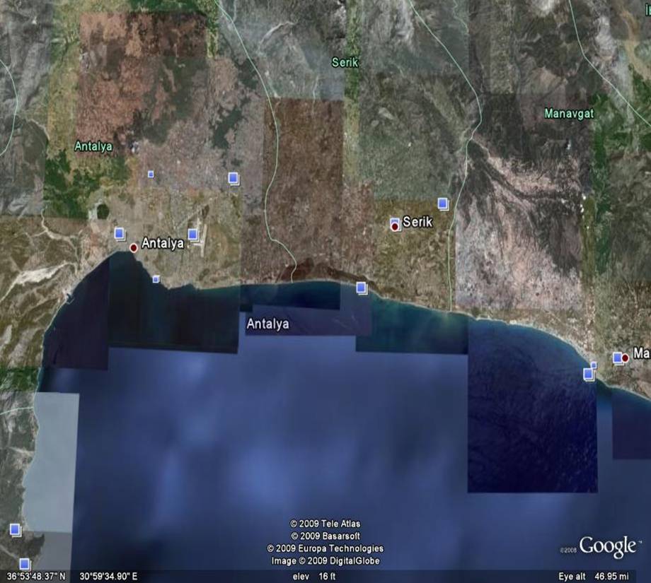
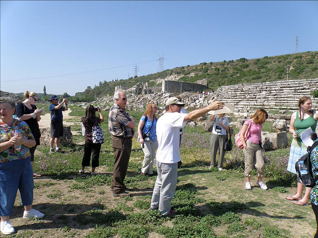
The next morning, we visited the ancient city of Perga – now called Perge. Perga is located about 9 miles northeast of Antalya, and was the capital city of the ancient province of Pamphylia. Pamphylia is bounded on the north by Pisidia and on the south by the Mediterranean Sea.
 Perga is mentioned only in Acts 13 & 14. It was one of the places visited by Paul and Barnabas on their first missionary journey. The province of Pamphylia, in which Perga is located, is mentioned 5 times in the Bible. Also, it is only mentioned in the book of Acts. There must have been a contingent of Jews in the province, for wefind them among the nationalities mentioned in Jerusalem on the Day of Pentecost (Acts 2:10).
At right is a shot of Antalya and Perga using Google Earth.
Perge lies in the plains of Pamphylia, eight miles up the Cestrus River (Modern name = Aksu R.). In ancient times, the Cestrus River was navigable and Perge had a port on the river. Today, because of centuries of silting, the river is not navigable. After the 10th century, the city rapidly fell into decay. And today there are extensive ruins which have been uncovered.
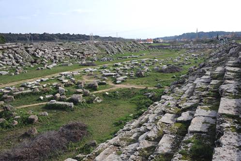

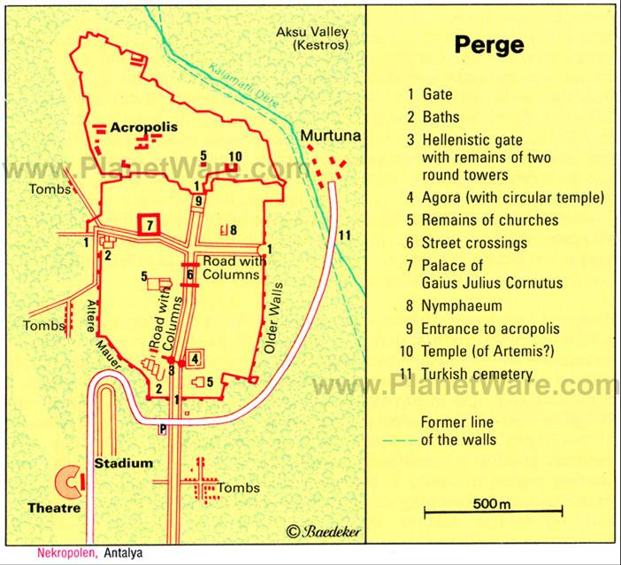
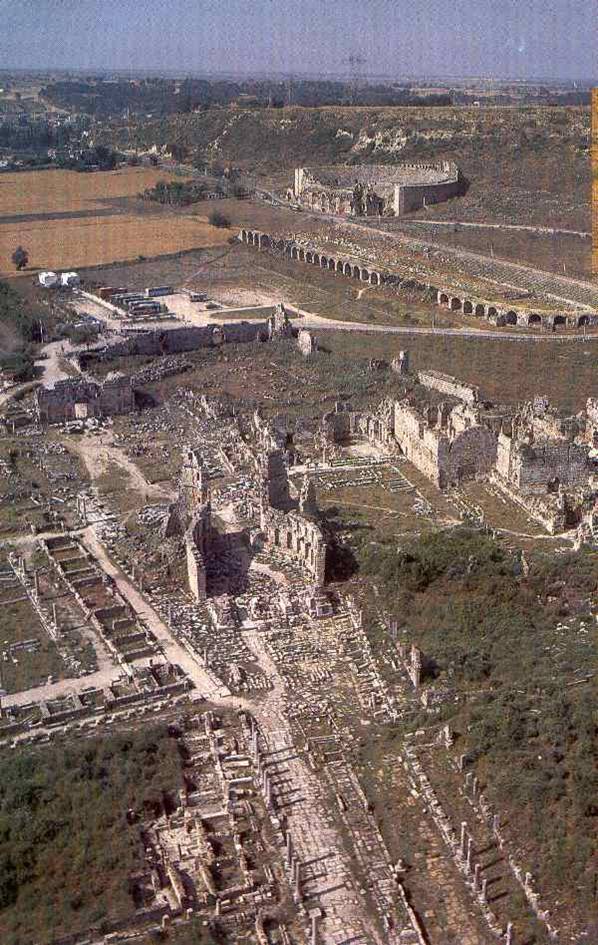
 Above-left is a layout of the ruins of Perga. The walls, which are flanked with towers, show the city to have been quadrangular in shape. We unboard our bus near the theater and stadium. Here is a picture of the stadium. In some ancient cities, the stadium could hold horse and chariot races. Thisoneat Perga most likely was not because it is much too narrow. Other cities would build Hippodromes in which to hold races. No hippodrome has been found here. The stadium was considered to be large as far as its capacity goes, being able to hold up to 12,000 people in its U-shape.
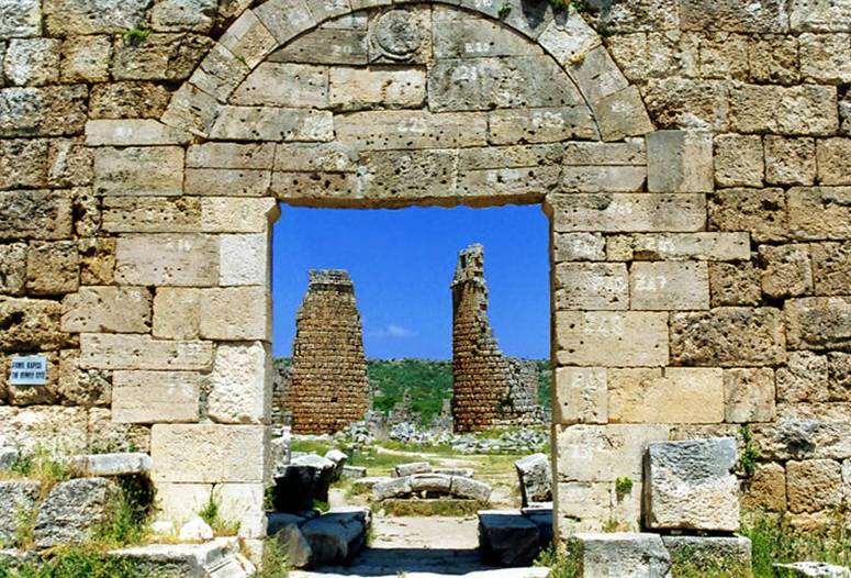
We walk from the stadium to the southern Roman wall (See photo above at far right). When you walk through this small gate, directlyahead you see the Hellenistic Gate, dating to 2nd or 3rd centurybefore Christ.
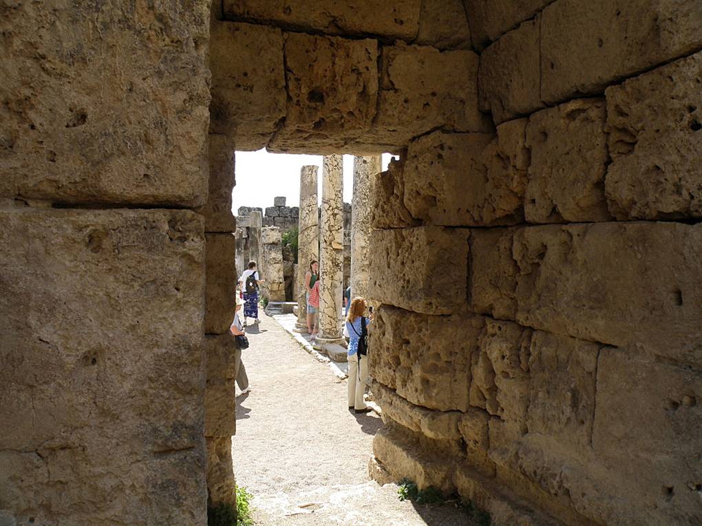
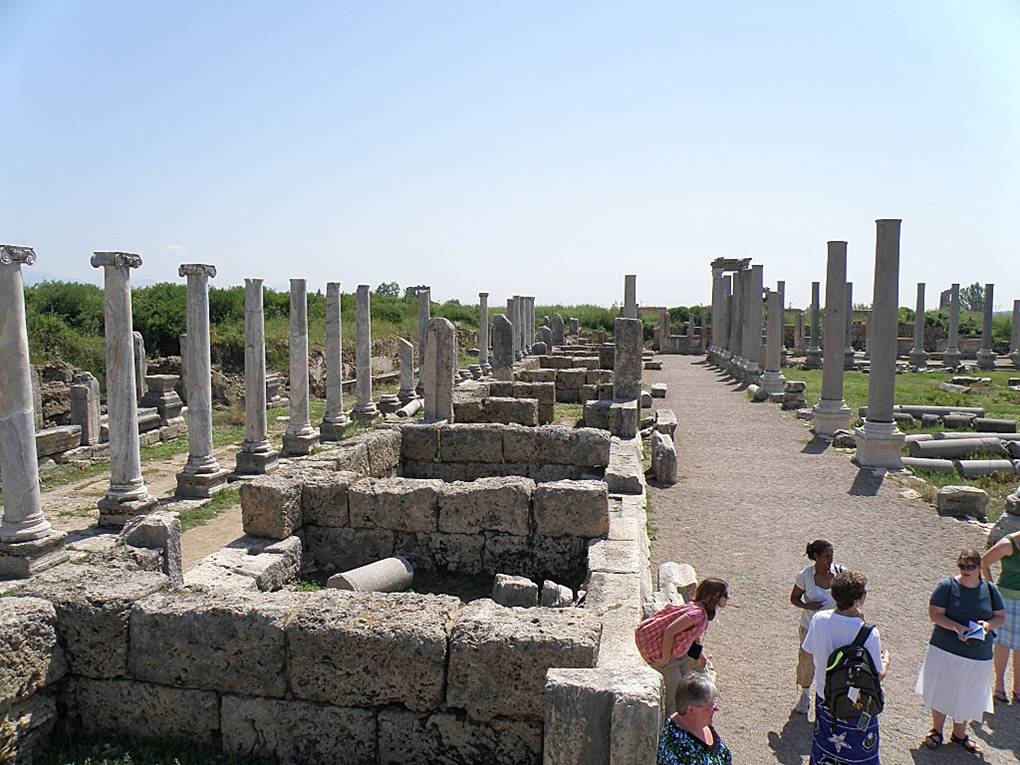
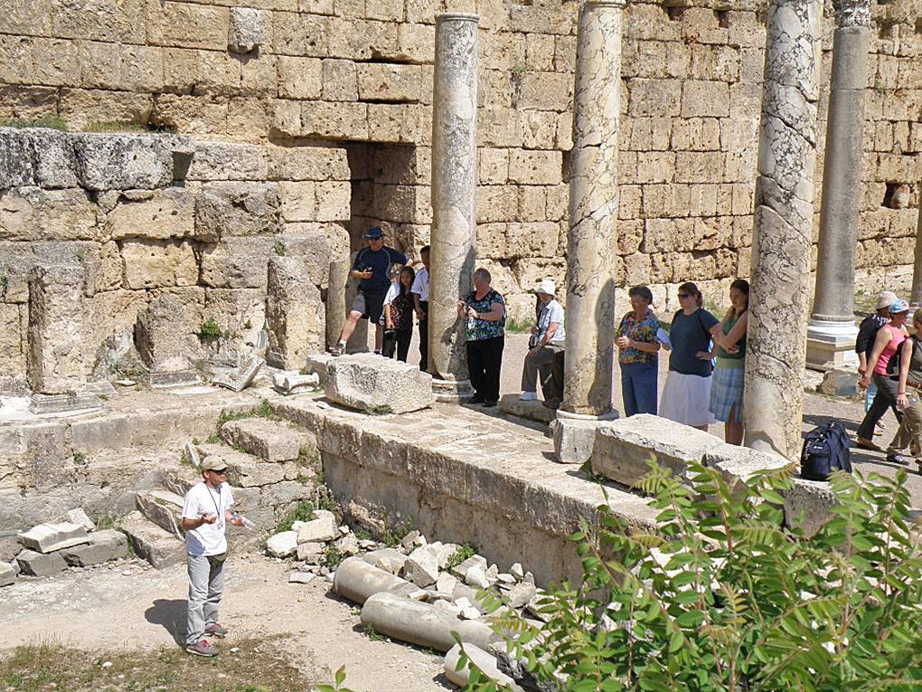
Here is an aerial view I got off theinternet. It is showing a view to thesouth. As I mentioned, we left our bus between the theater and the stadium. We then walked through the stadium, then to the southern entrance. Upon entering the Roman gate, we turned west to the bathhouses (in photo, that is to the right). Next to the aerial view is one entrance into the Roman Bathhouses. Next to the entrance door are some of the ruins of one bath house. The photo above-left is a picture of our university students and their professor. Starting from top, front row are: Danielle Stout, Kirsten Phillips, Tsehay Seyoum and one other student and in back row from top is Professor Dr. Kari Brodin and Erin Newman. These students were taking this trip for college credits.
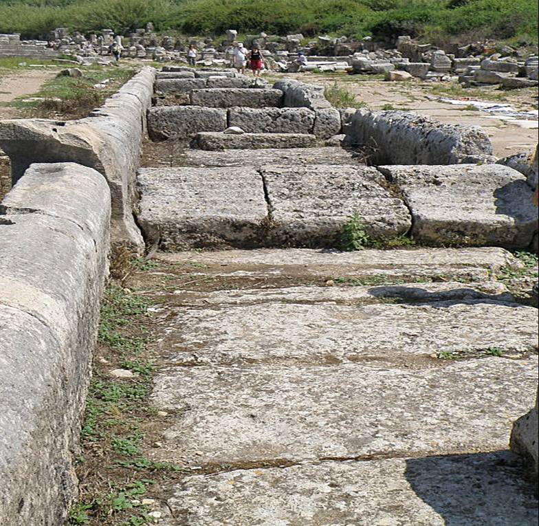
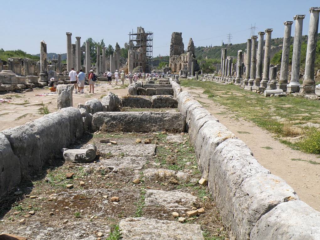 Look at the aerial view once again. Notice the wide north-south street. You will see there are many shops on both sides of the street. But I also want you to see the center of the street. Along the center was a water channel in which a stream was always flowing in ancient times. They were covered at short intervals by bridges. The stone cross-members would act to keep water in the center of the street constantly, as well as act as waterfalls along the street. The other photo at right is the water channel looking south towards the main Hellenistic gate.
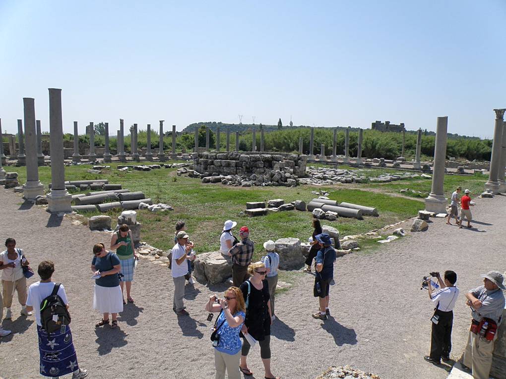
The photo to the far left shows the area of the agora – the marketplace. It is about 250 feet square, and surrounded by a colonnade. There were shops both in the square and surrounding it.
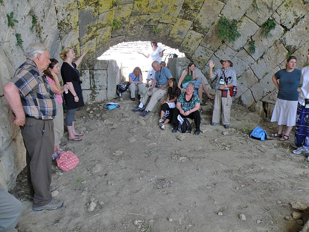
I want to return you to the stadium. Unlike many stadiums which have compacted dirt and rock on which the seats are layered, that is not true about this stadium. By walking to the backside of theseats, you will notice the openings under the seating. Here is a closer view to one opening. These were used as shops in ancient times. Some of these sections had no back wall, but opened to the stadium.
When we were in Perga, it was Sunday. We planned to have communion on this day, so before we left hom, I got some crackers and glasses from our church, and in Turkey had our guide acquire juice. And in one of those shops under the stadium seating, we had a faith lesson by Dr. Braddy and communion. We can worship our Lord anywhere. The Lord was with us all during this trip.
Aspendos
Now I want to take you to the city of Aspendos. Aspendos is located 17 miles straight east of Perge and about eight miles inland. The city was founded by Greeks around 1000 B.C. At that time the Eurymedon River was navigable as far as Aspendus, and the city derived great wealth from a trade in salt, oil, and wool.
In 333 B.C. Aspendus paid Alexander the Great a levy to avoid being garrisoned, but it tried to trick Alexander by ignoring its agreements with him and later was occupied. In 190 B.C. the city surrendered to the Romans, who later pillaged it of its artistic treasures. Toward the end of the Roman period the city began a decline and continued throughout Byzantine times.
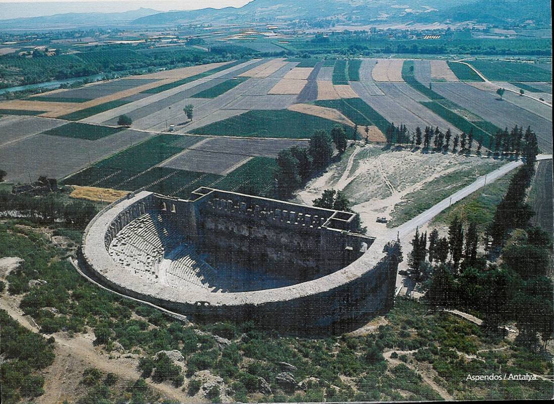
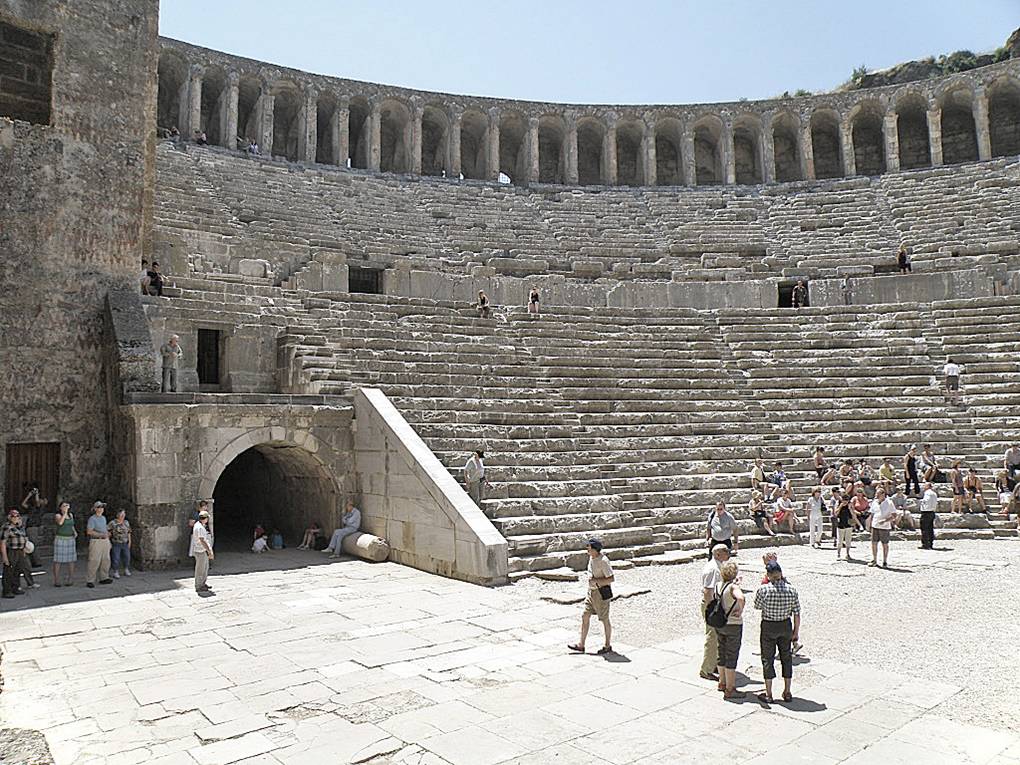
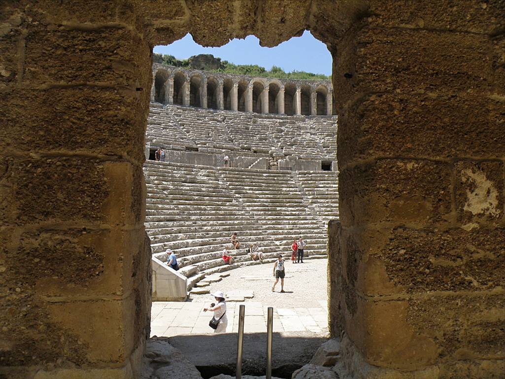
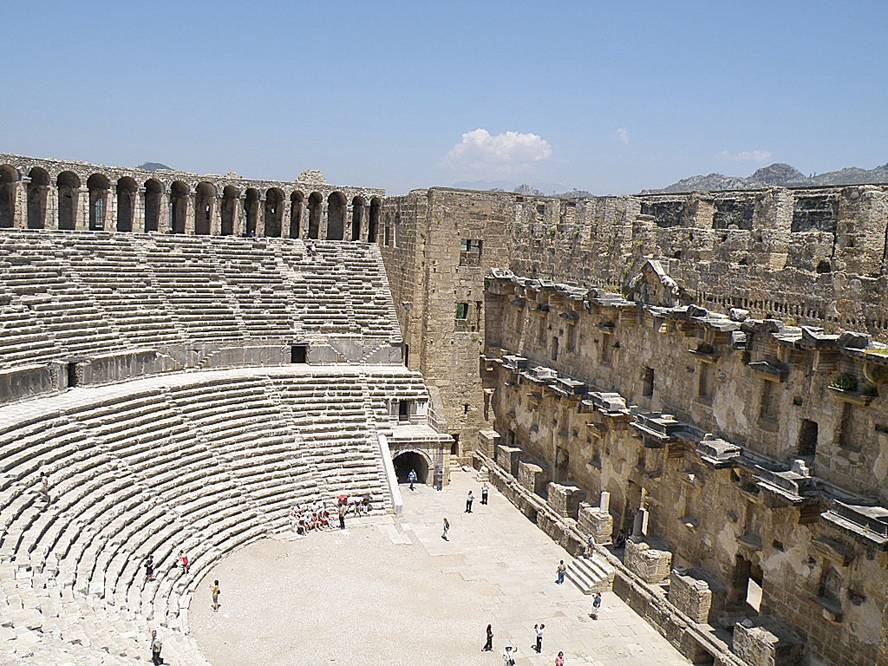
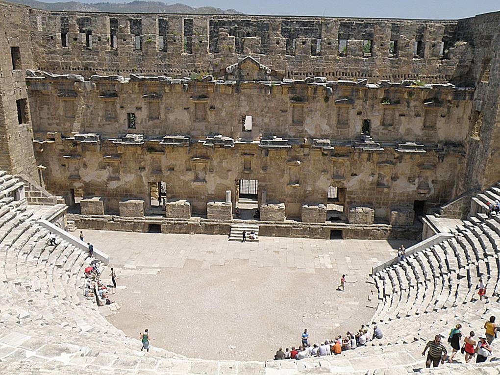
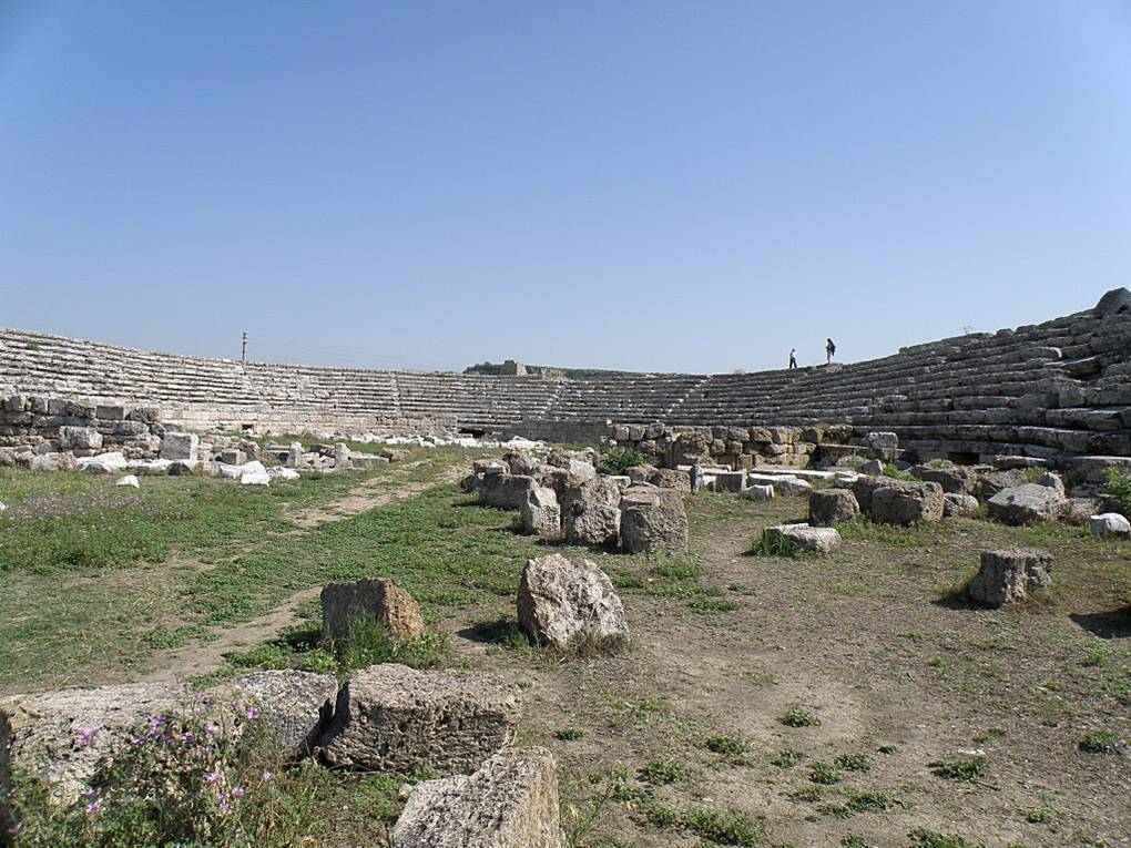
Aspendos is famous for what is probably the best preserved of all ancient theaters, having a capacity of 10,000 people and is still used today. The theatre at Aspendos is also famous for its magnificent acoustics. Even the slightest sound made at the centre of the orchestra can be easily heard as far as the uppermost galleries.
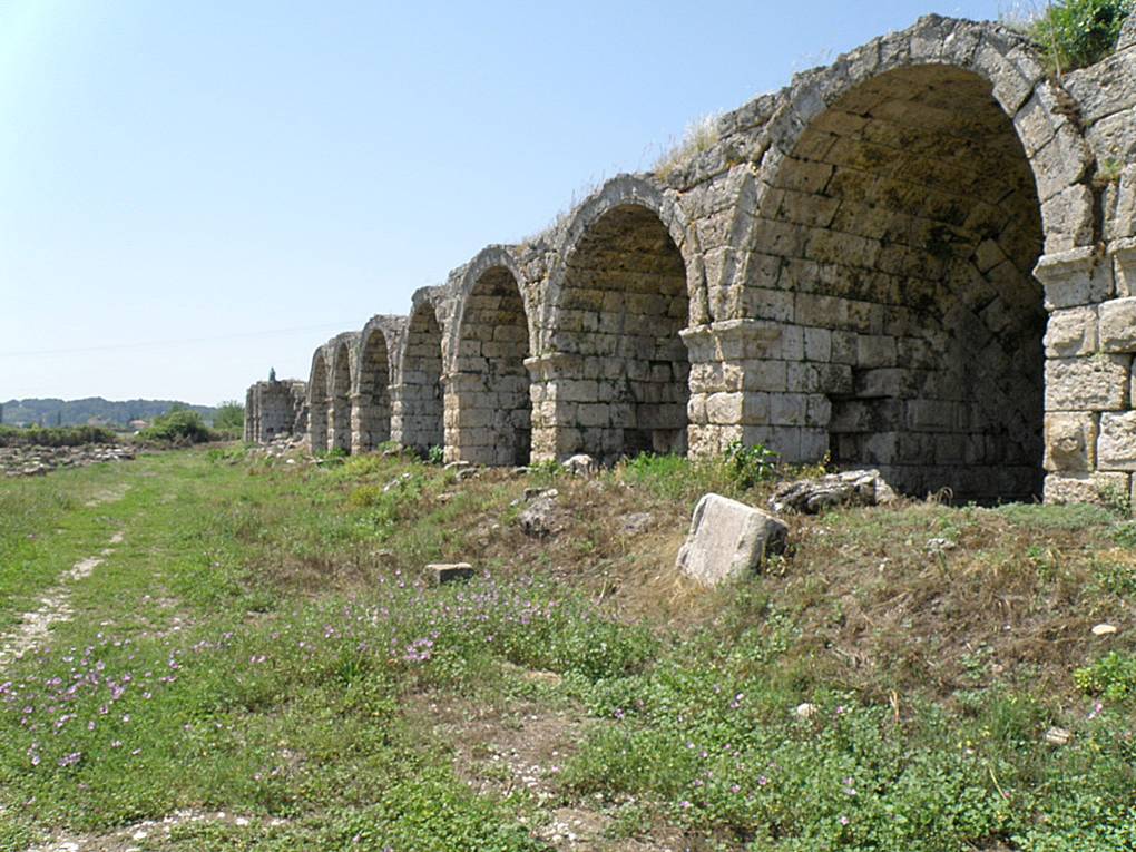
When a guide takes you to a site that was not on the original itinerary, it is referred to as giving us “candy.” That was not only true of this trip, but it seems to be a term all guides use. I presume they do that when they know we have the time in our schedule to add something. They don’t know in advance how long we might linger at one site. Well, our guide, Seyhun, gave us some candy at Aspendos. Not too far from the theater, he took us to see the ruins of an ancient aqueduct.
There are two kinds of aqueducts. Both use gravity to flow the water from a higher altitude to a lower. Some aqueducts are constructed to very gradually lower its altitude over many miles. These kind can have an open channel on top in which the water flows. That is what the aqueduct at Caesarea Maritima does. Here is a picture of the remains of that aqueduct.
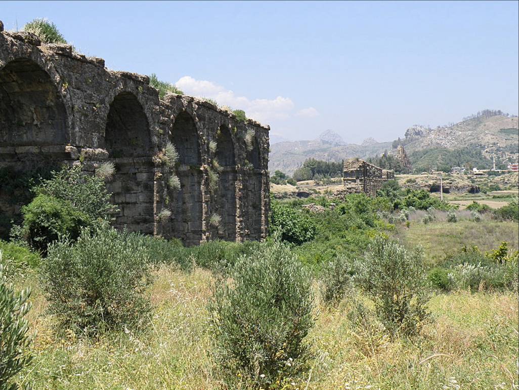
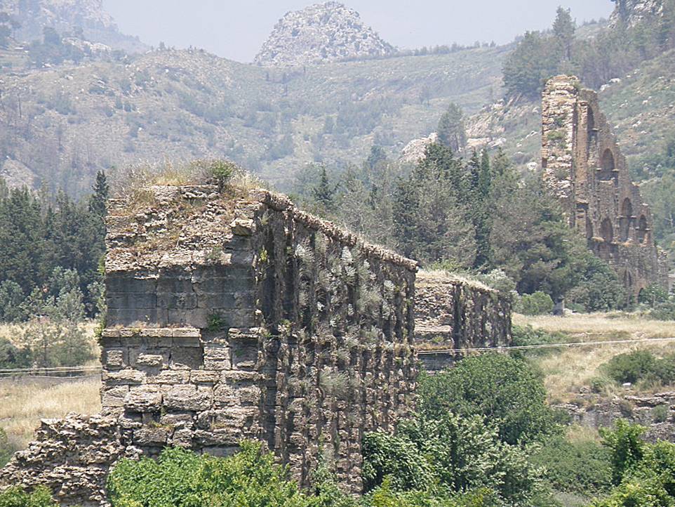
Then there is this aqueduct at Aspendos. You can notice that the water doesn’t maintain a gradual lowering of it altitude. There are places where its altitude increases and then lowers quite rapidly. Aqueducts of this type must use pipes, not an open flow. And as long as the end is lower than the beginning, the water will continue to flow. It is sort of like siphoning water out of a bucket using a flexible tube or hose. But it also means the connections between sections of pipe must be sealed so as to lose no water. I found that interesting.
Aspendos is not mentioned in the Bible, so I will not spend any more time here.
Antalya
We stayed in Antalya for two nights. Antalya is a large port city with a population of almost 800,000 people, and is the eleventh largest city in modern Turkey. It is the capital of the Antalya province – ancient Pamphylia. The city enjoys 300 plus days of sunshine and the average high and low temperatures for when were there is 83º and 63º. It turned out to be a little warmer than that. And the temperature of the Mediterranean water never goes below 59º (70º in the summer). Because of its very mild and sunny climate, even in winter, this is a popular vacation destination for not only the Turkish people but of all Europe.
It is not known when the city was first inhabited. Attalos II, king of Pergamum, was believed to have founded the city around 150 B.C., naming it Attalia and selecting it as the base for his naval fleet.
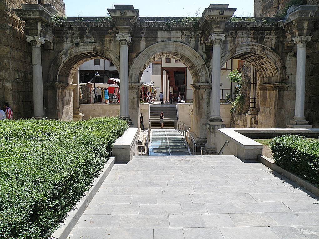
During the second century, Emperor Hadrian conferred the status of colony on the city and visited Attalia in 130 A.D.. The Hadrian Gate was built to commemorate this visit. Also, in the photo at far right, take a look at the ruts worn in the stone by many carts and chariots over its history.
